
Back in June of 2018, I took the one-year old AT out to ride up to Hayden Pass which is about 35 miles west of Canon City. Couldn’t get the 500+ pound AT through a section and ended up turning around. That post is here.
So today is the day I take KLiX to see Hayden Pass.
After a nice ride across US-50 to the Hayden Creek turn, I’m on gravel road and looking at a mountain that I will soon be on top.

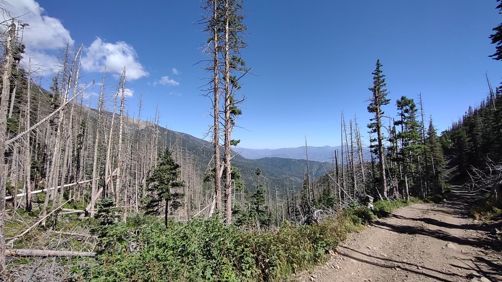
And before I get to the Forest Service Road 6, I can see burn areas from the 2016 fire.

After passing a resort and some private camping property, I arrive at the Hayden Creek Campground which is run by the U.S. Forest Service.
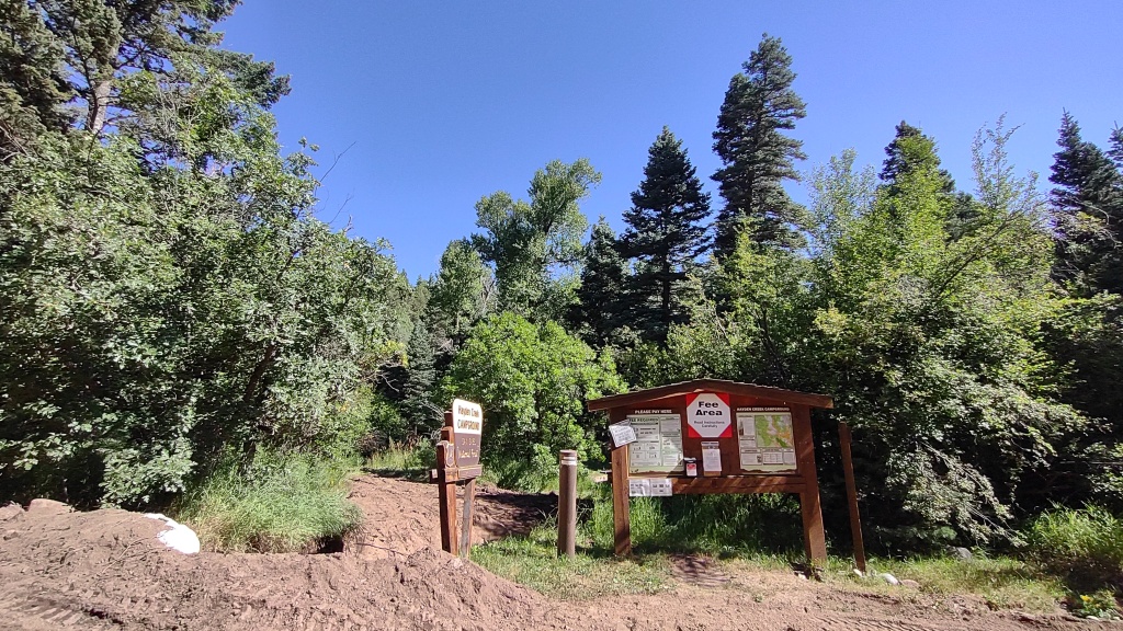
KLiX is parked in the shade while I take some pictures.
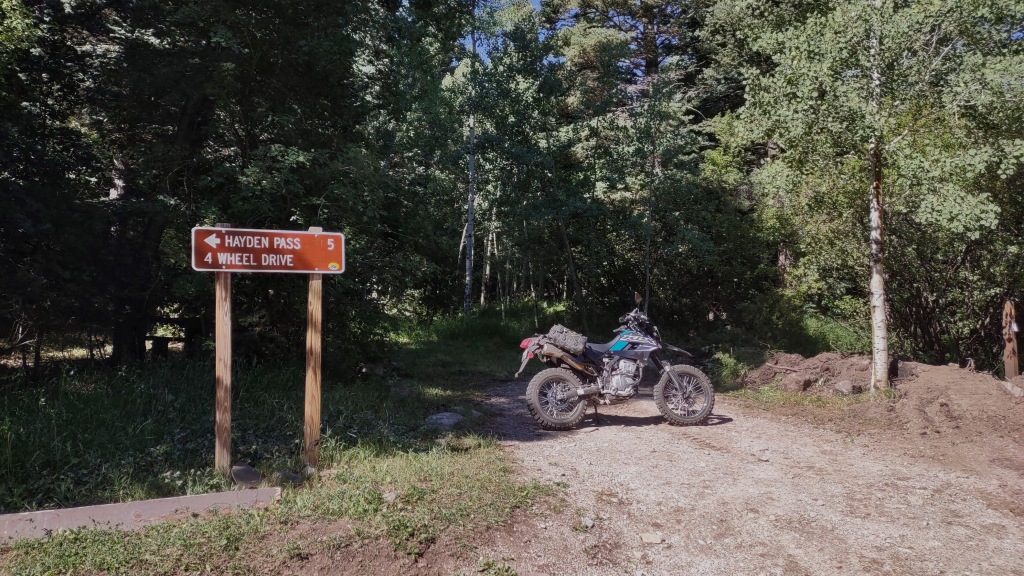
After taking couple of pictures, I need to turn around and take the trail on the right.

This marker gives an idea of the difficulty.

One-wheel drive motorcycles are ok.
Now for some pictures taken during the climb to the pass. I was the only one up there today. 😁


And just like that, KLiX tractor’d up the trail to the pass! 💪


There’s a trailhead here too.

After contemplating where to go next and a snack, I backtrack the way I came up as I want to stop in Cotopaxi for fuel and a cheeseburger.
Here are some pictures taken on the descent. Now the sun is behind me and the lighting is better. Plus, it’s a different view!


Refuel and cheeseburger time!

About a mile or two east of here, I saw an interesting road that appeared to have a BLM sign. I’ll go check it out now.

It’s dry and it’s getting hot in the sun. The two-track trail has me thinking of rattlesnakes and steer skulls!

No prior planning, I don’t know where this is going, and I have half a bottle of water.

As expected, KLiX does well in the sand. The wide tires help float the bike and rider.
After about three songs, I stop and turn around. On the way back, I stop at a pile of tin cans. There are a lot and probably have been here for decades as some have the old pull tops. Maybe dumped here prior to recycling?


Near the gate, I ride under US-50 and stop for a picture.

From here, it was about 20 miles back to Canon City. About 85 miles for the day.
Thanks for checking out the pictures! 😁

That’s a great track up to the pass. Looks like real fun! I guess all tracks that are too narrow for a sidecar are fun, right 😉?
LikeLiked by 1 person
Would at least need the 2wd Ural hack for an attempt at this. Several times I was considering what it would be like in a Jeep (Wrangler).
LikeLiked by 1 person