After riding the AT, KLiX got out for a quick ride as well. It has been a few months since KLiX was ridden or even started. The engine fired like it was ridden yesterday.
Intention was to make a small loop; but, wanted to go see a culvert bridge that was being rebuilt last year. If completed and open, this would be a nice loop.
The culvert bridge of interest is still months from being completed.
So, I continue the same direction and maybe I can get back before getting too far out. It’s 60 degrees; but, without a windscreen the wind is penetrating my jacket and the wind chill factor can take it’s toll quickly.
The road keeps going and enters Tennessee. Making turns based on the location of the sun keeps me going further south and eastward. Eventually, I stop to push the map around in the GPS. Then, pick a location and set it as a destination.
I’m on some roads I haven’t ridden before and soon another let-down is ahead. It’s for Webb Branch that feeds into Drakes Creek.
Culvert bridge over Webb Branch.KLiX
Soon enough I’m back in town and take one more back road to the house. 20 miles and about half an hour of riding.
Back in June of 2018, I took the one-year old AT out to ride up to Hayden Pass which is about 35 miles west of Canon City. Couldn’t get the 500+ pound AT through a section and ended up turning around. That post is here.
So today is the day I take KLiX to see Hayden Pass.
After a nice ride across US-50 to the Hayden Creek turn, I’m on gravel road and looking at a mountain that I will soon be on top.
About a ten miles to the top.
And before I get to the Forest Service Road 6, I can see burn areas from the 2016 fire.
Burn scar from 2016.
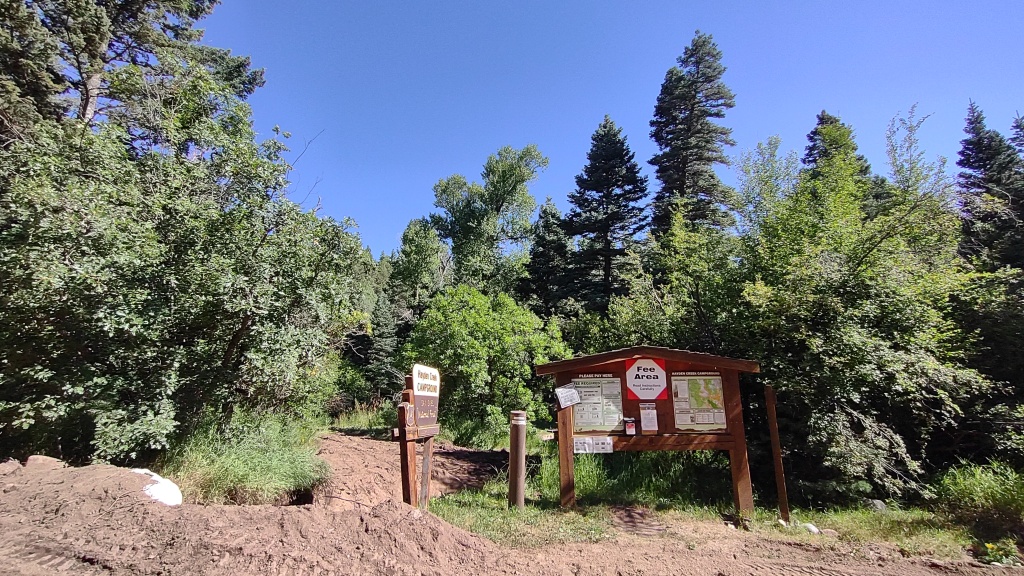
After passing a resort and some private camping property, I arrive at the Hayden Creek Campground which is run by the U.S. Forest Service.
The “iron ranger” at Hayden Creek Campground.
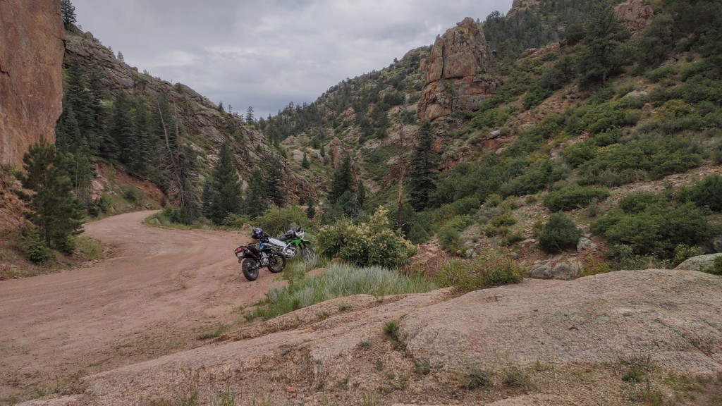
KLiX is parked in the shade while I take some pictures.
KLiX.
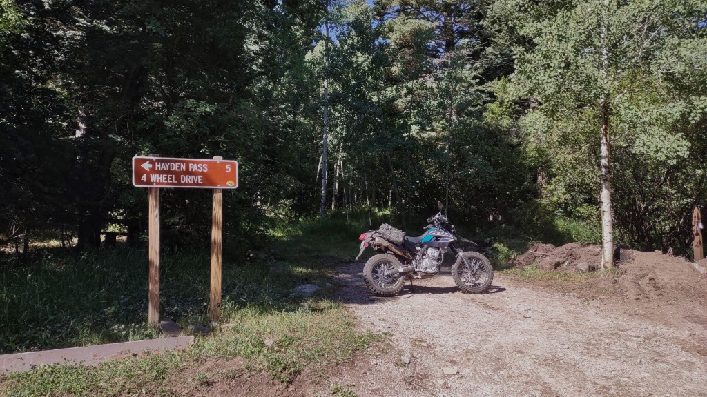
After taking couple of pictures, I need to turn around and take the trail on the right.
Five miles to Hayden Pass. How hard can it be?
This marker gives an idea of the difficulty.
“Stay the Trail!”
One-wheel drive motorcycles are ok.
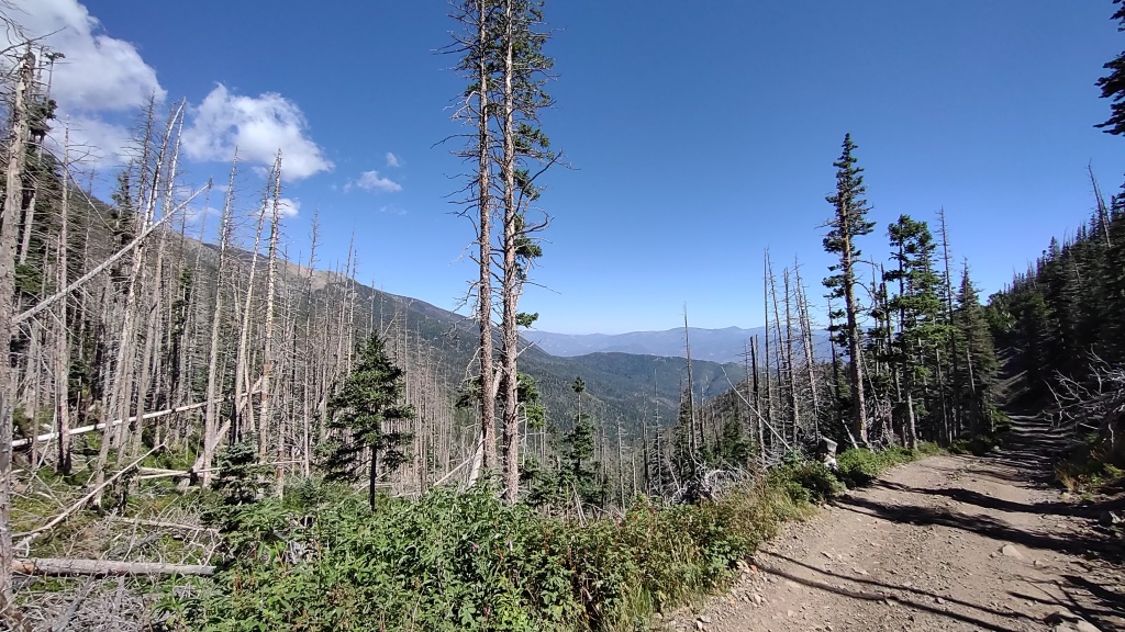
Now for some pictures taken during the climb to the pass. I was the only one up there today. 😁
And just like that, KLiX tractor’d up the trail to the pass! 💪
The picture is the prize! 🏆
There’s a trailhead here too.
After contemplating where to go next and a snack, I backtrack the way I came up as I want to stop in Cotopaxi for fuel and a cheeseburger.
Here are some pictures taken on the descent. Now the sun is behind me and the lighting is better. Plus, it’s a different view!
Plenty of burned trees up here.The burned trees are crumbling now.Looking towards the Arkansas River Valley and US-50.Now almost at the bottom and the Hayden Campground.
Refuel and cheeseburger time!
Cotopaxi Store.
About a mile or two east of here, I saw an interesting road that appeared to have a BLM sign. I’ll go check it out now.
Open the gate, roll KliX through, and then close the gate.
It’s dry and it’s getting hot in the sun. The two-track trail has me thinking of rattlesnakes and steer skulls!
South Fern Leaf Gulch Road.
No prior planning, I don’t know where this is going, and I have half a bottle of water.
Sand and rocks.
As expected, KLiX does well in the sand. The wide tires help float the bike and rider.
After about three songs, I stop and turn around. On the way back, I stop at a pile of tin cans. There are a lot and probably have been here for decades as some have the old pull tops. Maybe dumped here prior to recycling?
Near the gate, I ride under US-50 and stop for a picture.
Culvert for rain run-off and large enough for a flash flood.
From here, it was about 20 miles back to Canon City. About 85 miles for the day.
Did a local ride of a favorite local loop. This time BiL Kent is definitely interested in the ride too. We linked up at an intersection at the southern end of CO-67 (Phantom Canyon Road) at 8am as rain showers are possible in the afternoon.
Within a few miles we arrive at the official beginning of the Phantom Canyon Gold Belt Tour.
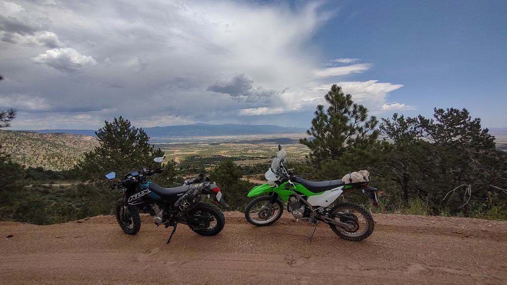
A couple of Kawasaki KLX dual sport bikes.Beginning of the Gold Belt Tour.
Riding north, the elevation is a slow, gradual climb to about 10k feet at Victor, CO.
With that climb and our progression getting a little more north, the air temperature cools and soon some random rain drops.
There’s a few bridges, but this one is the most scenic looking.
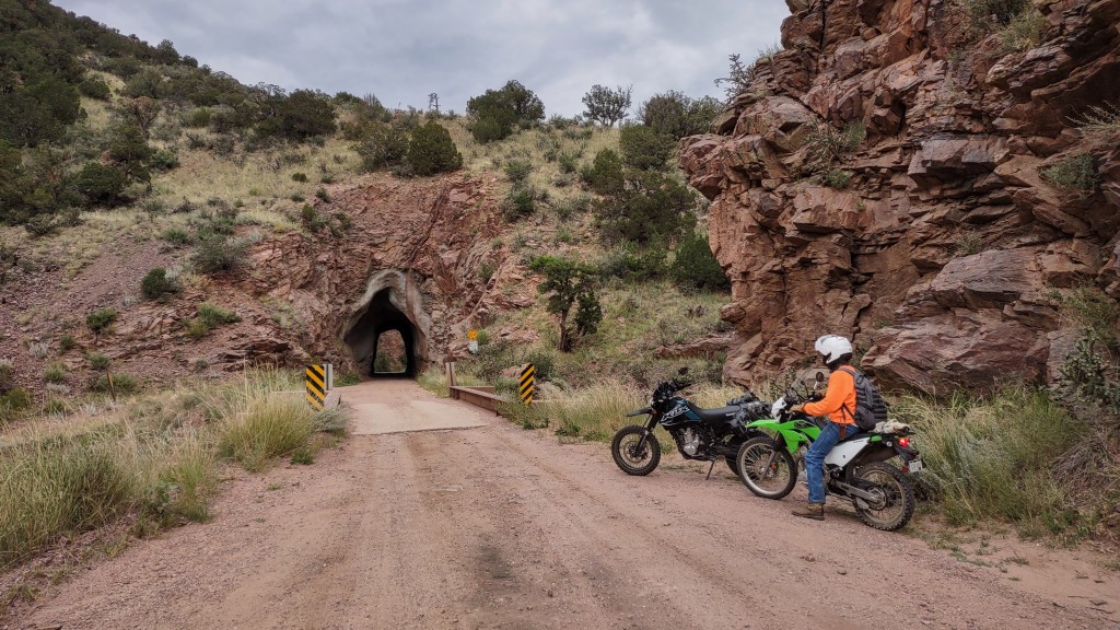
And a couple of tunnels too.
First of two tunnels.
Not too much further up the road, we are over 9,000 feet and the rain is a drizzle, so we stop to add some rain gear.
No cell signal to check weather radar. We arrive at Victor, and the weather isn’t the best. Neither bike needs fuel, so we simply cut through Victor and head over to Cripple Creek to pick up the Shelf Road back to Canon City.
We are carrying some snacks and look for a place to take a break. After riding south about five miles, we are out of the rain.
Shelf Road.
This spot looks fine for a break.
Break time!
Some interesting colors under the cloudy sky. While it doesn’t really show in the picture, the pinecones look a bit purple.
Good looking trees.
With sun visor on my Arai helmet, I missed seeing the Window Rock. Bummer for me, but Kent did get to see it.
Plenty of views worth stopping and taking a picture.
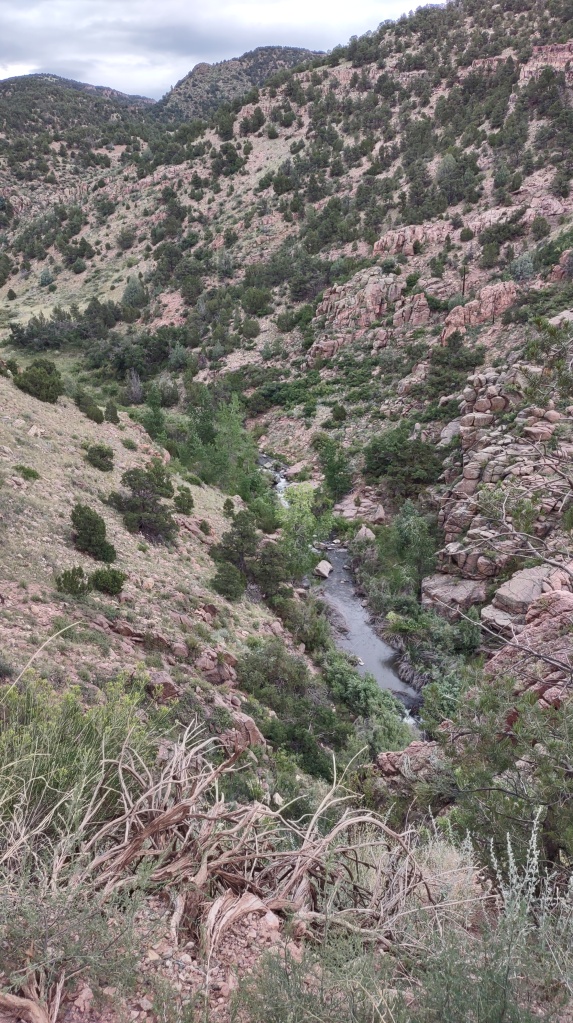
Looking down from Shelf Road.Arkansas River valley in the distance.
So we are close to being back in Canon City and it’s early. Weather looks better too.
So, let’s take a run through the Red Canyon Park!
It doesn’t take long to get through the park and then we would be riding some county roads.
Then, we ride up on some ruins.
KLX’s and some ruins.
After leaving the ruins, the road gets really fun. We encountered steep climbs, loose rocks, sand, and even some steps before arriving at US-50 west of Canon City.
About a mile down the road is the entrance to Skyline Drive.
I never get tired of riding or driving up Skyline Drive.
At the top, we take a quick look of Canon City before our coasting race down hill. 😆
KLiX apparently rolls better than the KLX-230! 🏁
That’s it for this ride. Thanks for checking out the pictures. 😀
I’m here now in Pagosa Springs; so, I’m going riding as planned.
Unload KLiX from the truck, toss on the saddle bags, mount the GPS’s, and I’m ready to go. Heading south on the first planned track.
I have to ride back into town to pick up Trujillo Road that goes south and sort of follows the San Juan River. Plenty of Cottonwood trees along the river bank as expected. It’s a wide gravel road with fenced private property on both sides. Kind of junky looking really. Then, the road isn’t as groomed and the ranches start to disappear.
About 20 miles south, southwest of Pagosa Springs, I start to climb a hill and in the river valley below, I spot a bridge. A railroad bridge. An iron railroad bridge. The Durango & Rio Grande Western Railroad San Juan River Bridge to be exact!
I make a u-turn for the photo.
The D&RGW Railroad bridge in the river valley.Another view of the bridge.
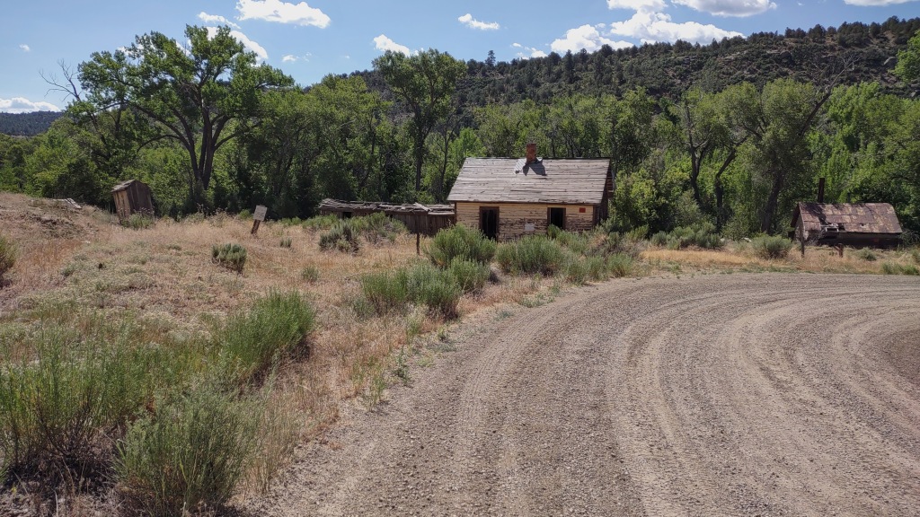
Continuing along the route and a few miles from the railroad bridge, I’m overlooking some delapatated buildings, a pink church, and another railroad bridge.
I ride down for a closer look.
There’s even an outhouse here!Narrow guage railroad car, well because there are tracks.
These orange signs get my attention.
Yep, there’s a reservation here.
Around a couple of curves, I am at the barracade I noticed from above. I need to cross this bridge! Well, that was the plan anyway.
As close to the pink chuch I could get.
Turn around time. Looks like the route is cut really short. This is the only route that goes to the reservoir that is about ten miles up the road.
I take another road that leads back to US-160 and I head for refuel in Pagosa.
After topping off the gas tank with about half a gallon of fuel, I head back through town to the east side where I’ll pick-up a national forest road.
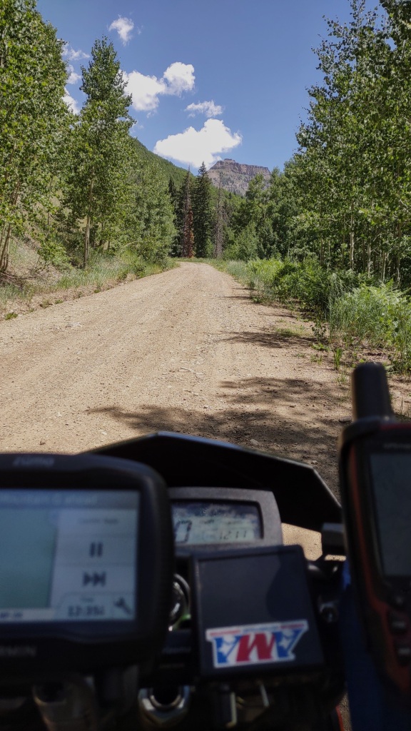
It’s another gravel road. This one slowly climbs into a national forest and I’m seeing Aspen trees mixed with the Pines.
About eight miles east of Pagosa Springs.Just another nice view!
There is a logging operation happening in this area. I pass a couple of trucks loaded with timber. Then, I’m in the cutting area. Lots of Forest Service vehicles and personnel along the edge of the road. I sneek by a loader and in a couple of miles I’m at the end of the road.
I still have route showing on the gps; so, I go around a couple of parked vehicles and a dirt berm. No sign to stay out until I go about 50 feet.
Turn around time!
I ride back to the parking area and take a break–and some photos.
Looking back to the west and Pagosa Springs.
After a short break, I start back down the road and notice another national forest road to the right. It’s narrow. Could be nice adventure.
Nice trail, right?
About one third of a mile into this excursion and encounter this:
No chainsaw handy for this!
Even if I could get over this log, there’s no road.
Another turn-around point.
Back on the main road, there are still some nice views.
Plenty of beetle-killed Pines in the area.
Quickly, I encounter the loader again. This time I get a vid of it being worked.
Log loader in action.
About ten minutes later, I’m back in town and refueling again. Back at the hotel, I load KLiX back on the carrier.
Road two of the three planned tracks and am satisfied with what I’ve seen.
Time to do some more research about the truck problem and come up with a repair plan.
Have been doing some planning and creating tracks to ride in an area I’ve passed through several times. Now it will be time to explore.
It’s about four hours of driving from Canon City to Pagosa Springs.
Driving down US-285.Tunnels are always impressive.Pretty cool, huh?
An obligatory stop and photo at the summit of Wolf Creek Pass.
An informative display about the naming of the pass and the continental divide.
But wait! What’s this?
Check engine light. 😒
Get into Pagosa Springs and head to the Advanced Auto Parts and check the resultant code. Wanted to believe the six year old battery was failing in the heat. Nope. There’s an intake manifold problem.
Need to do some research, so I head to the hotel.
Research results and a phone call tell me there are no parts available.
Fremont Motorsports sponsored a St. Jude 100-mile ride today.
Poster for the St. Jude ride.
My little sister’s hubby, Kent, wanted to ride and brought his KLX-230. We linked-up at Fremont Motorsports.
After a sign-up and a few minutes of standing in the warming and quickly becoming hot sun, we decided to leave ahead of the scheduled “kick stands up” time. We also didn’t take the planed route and chose to ride the dirt Oak Creek Grade road that would be a somewhat direct route.
First stop for a picture. That is Pike’s Peak in the distance.
Riding Oak Creek Grade is fun. There is wash-board to chatter the teeth, sand and marble rocks to keep the riding reflexes on alert, good views, and little traffic.
A point of interest a couple of miles from Glencliff. Something about Zebulon Pike and his travels.
After arriving in Glencliff, we headed to the gas station. Both bikes took one-half gallon of fuel each.
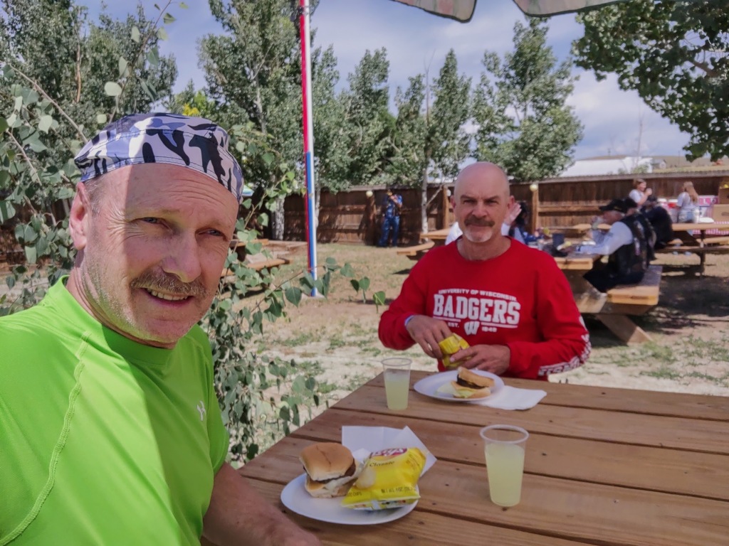
We beat the masses here. Within minutes we were pointed to the chow line. Army guys know about chow lines! Except, there is no line. In seconds we had our cheeseburger, chips, and some lemonade for lunch. All part of the charity ride sign-up.
Lunch time!
After eating and vacating the table so the riders in a somewhat long chow line could have a place to sit. Afterwards, we ended up standing by the bikes. Only three dual-sport bikes in a crowd of v-twin cruisers and Can-Am Spiders. Under the hot sun, we decided it was time to head back. Took the same route back which is better with our dual-sport bikes.
Silverdome Saloon in Glencliff, Colorado. Pretty-much all the bikes were here at this point.Plenty of time for a short break in an area with some nice scenery.
Kent riding by on his KLX-230.Through the trees is the Arkansas River Valley.Last of the scenic views before descending into more hot air.
We returned back to Fremont Motorsports for a few minutes and learned there were 178 participants this year. A record for this event. KLiX added about 83 miles round trip.
This morning was the first ride since arriving in Colorado about 12 days ago. Temperature was cool at about 70 degrees. Didn’t plan to ride long–just needed to ride KLiX since removing all the side panels, fuel tank, and headlight assembly a month ago.
So I head towards Red Canyon Park but missed the entrance and within minutes I was at the Shelf Road Terminus in Fremont County. Have ridden Shelf Road with the AT and the former 690 ER and will take KLiX for the full ride sometime next month.
Shelf Road Terminus
I would only ride to the first creek crossing before turning around. The “dirt wheels” are working well and the front fork responds to ruts and pot holes fine for a street spring.
Here are some pictures taken along Shelf Road:
Looking south towards Canon City and the Arkansas River Valley.Looking to the north.A view of Shelf Road and the scenery from behind the bars.At a Four-Mile Creek crossing and the turn-around point. Continuing to the north, a 4X4 is recommended although a grocery-getter SUV could make it through.Crossing the Four-Mile Creek.
Here I could smell the creek water, vegitation, and cooled morning air. It’s a great aroma that is typical of the Rocky Mountains.
Heading back, I pick up the pace a bit to get used KLiX and the “dirt wheels” rolling across loose dirt, rocks, and sand. Front brake to slow and rear brake to slow and steer! There’s not much weight on the back wheel, so KLiX is sliding like a proper dirt bike. Good stuff!
This time I spot the entrance to Red Canyon Park. I rode here last year for the second ride on KLiX after purchase. Still had the OEM street wheels and tires. Only went into the park for about three miles.
Red Rock Canyon and a typical rock formation.
From here, it was about 15 minutes back to the house. About 30 miles and a little over an hour.
Have wanted to see the Buzzard’s Roost for a few years now. Somehow I didn’t get there in ’21 with the AT and I was just about there.
About 20 minutes up the route from the basecamp is the town of Marshall. It has a neat vibe to it. My head is swinging let and right at the posted 25mph speed limit to take on what I can. The gps tells me to turn left which is a bridge across the French Broad River. I stop on the side of the road before the bridge to look around. Lots to see.
With the sun on my left, I spot a location on the other side to take some photos.
Having crossed the bridge, pulled into a parking lot, and this is what I see.
One picture with KLiX and one without.
Looking across the French Broad River to the town of Marshall.Viewing the town of Marshall, NC.
After leaving the parking lot, I make it about 25 feet before stopping for more pictures.
Madison County Courthouse at the end of the bridge.
From here, the route is going to be spectacular.
But first, a reflective selfie! 😆
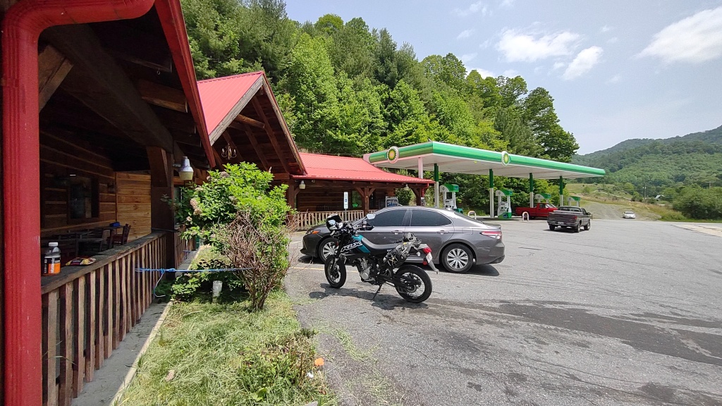
Further along the route is a planned stop for fuel as KLiX cannot make the whole 120 mile route on two gallons of fuel. This general store is in the town of Trust, NC. Not sure it’s an actual town–rather more of an area.
Refueling at the Trust General Store.
About 45 minutes after leaving the general store in Trust, I pass under I-40 and pick up the road to the Buzzard’s Roost.
This is a water crossing for NC-288 over the Pigeon River.
Crossing the Pigeon River.
About half a mile from hear, the pavement ends. It’s coarse rock on hard packed dirt making for a jarring ride when combined with pot holes and washboard. All good. KLiX don’t care! 😆
From here, it would be about eight miles to Buzzard’s Roost via a Forest Service road. Single lane.
Once the gps tells me I’ve arrived, I continue for about 500 feet looking for something more obvious; and, turned around quickly. The point is marked by some paint on a tree trunk.
Trail markings on a tree.KLiX at the Buzzard’s Roost as marked by the paint on a tree.
A short 50 foot hike from the road is this area. It’s starting to look like a viewing area.
Closer to the edge, I can see I-40. It’s a long way down there!
Another selfie.
Dude!Looking straight down from the ledge.
From the Buzzard’s Roost, my route is planned to back-track for a while.
Then, I’ve got KLiX working hard for a slowish but aggressive run up the Rattler NC-209 to the town of Hot Springs. Good clear road with the exception of the three Harleys and a Goldwing I encounter while totally in the sport-riding zone. I get around that tight pack in a few curves. The tires were working great and this pavement is smooth with little debris.
After I get out of the hills and through Hot Springs, the road straightens and soon I’m under an I-26 overpass. The Tennessee state line is about two miles to the north.
Four lanes of interstate roadway above us.
Around the corner from the bridge is a place I spot to take a break. I get a bag of chips and a drink. While at the cash register, I see an old photo up on the shelf behind the cashier. She notices I’m looking at this photo and I ask “Is that…?” “Yes, ….” It’s an old picture of Donald Trump with the business owner who was a chef for Trump at one of his Florida properties.
Station owner is a former chef.
From here, it’s about ten miles back to the basecamp. A quick refuel stop, and I’m finished riding today.
After a break, I walk down the drive for some exercise. There’s a demolished Texaco station and an abandoned restaurant. Both would have been busy on the 60’s and 70’s judging by the design of the restaurant building.
In a far corner, I notice a sign for a cemetery and I go investigate. Most were buried in the late 1800’s.
Cemetery at the I-26 exit for Mars Hill, NC.
That’s it for today. No plans for riding tomorrow. Thanks for checking out the photos. 😁
After about five hours of driving, I’m at my basecamp that’s about 20 miles north of Asheville. After arriving, stuff gets removed from the truck, take a short break, and then hop on KLiX for a short ride.
About ten minutes into my route, the pavement ends! Oh, didn’t see this coming. KLiX don’t care! 😆
Gravel roads are always welcome.
Even with the street wheels and tires, KLiX is getting enough gription. (werd!) 😁 In fact, KLiX has more traction than power. No power sliding like the former 690ER. Poor KLiX. 😆
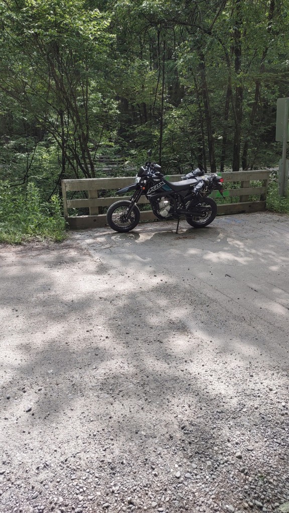
Up the road a bit there’s one of many hairpin turns. Since there is running water in this area, there are two bridges right here. A second bridge can be seen above the front wheel.
Two bridges.
Also, some nice running water.
Then another hairpin turn that makes for a good picture.
N. Fork Road about ten miles east of Mars Hill.
And a picture of KLiX. Just because. 🤟
KLiX looking like a fun ride!
After about five miles of gravel, I’m back on pavement and time to scrub the dust off the tires.
Moments later, I come around a curve and see this clearing under the trees with the road zig-zagging back and forth. Get a couple of pictures and then work on cleaning the chicken strips.
This is how this section of road looks in Google maps.
Zipping along the road, I get a glimpse of a city limits sign. Pensacola. Uh-oh. Last time I saw Pensacola, I was in Florida. Did I pass through a black hole portal and end up in Florida? 😆
Probably not; but, here’s a picture of the town’s volunteer fire department
Pensacola, NC fire department.
Eventually, I’m back on a major road and heading back to town. Need two things–dinner for me and gas for KLiX.
The hotel attendant mentioned Stackhouse. So, after seeing it, I spot a parking spot right out front. Did not hesitate to claim it for parking. Once inside, I get a table where I can keep an eye on KLiX–wouldn’t want that rascal trying to get away. 😆
Had a pretty good pulled pork sammich with red cabbage, pineapple slices, and tasty habanero salsa with a side of fresh sweet potato fries. Unsweetened iced tea to go with it. 👌
Stackhouse
Across the street is a lot that seems like a park. The flags and lamps are nice street decor and good for a picture.
Main Street and Carl Eller Road.
After this, it was a short ride for gas and then on to the basecamp for the night.